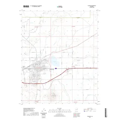
2020 Map of Tucumcari
USGS Topo · Published 2020About this map
Tucumcari serves as a hub of eastern New Mexico commerce, situated at the base of the prominent Tucumcari Mtn. This modern survey reveals a landscape shaped by water management and transit, where the Quay County Courthouse and Mesalands Community College anchor the city center. The surrounding plains are crisscrossed by a complex irrigation network including the Farm Lateral, Savage Lateral, and Tucumcari Lateral, which direct water across the dry terrain north of Hittson Cr. To the north, Tucumcari Lake and Pajarito Cr define the hydrological character of the basin near the San Miguel Co Quay Co line. The urban grid is heavily influenced by transportation corridors, with W Railroad Ave and W Tucumcari Blvd reflecting the town's history as a railroad and highway stopover, while local history is preserved at Tucumcari Memorial Park.
Find a feature on this map
99 named features on this map. Tap any name to fly to it.
Don’t see what you’re looking for? This feature index may not catch every label — zoom into the map to look around manually.
Map Details
Editions of this 2020 Tucumcari Map
This is the sole edition of this map. No revisions or reprints were ever made.
Other maps of this area

1930 · Tucumcari
USGS Topo · 1:125,000

1954 · Tucumcari
USGS Topo · 1:250,000

1958 · Tucumcari
USGS Topo · 1:250,000

1967 · Trinchera Creek
USGS Topo · 1:24,000

1967 · Liberty Mesa
USGS Topo · 1:24,000

1967 · Tucumcari
USGS Topo · 1:24,000

1968 · Bascom Camp
USGS Topo · 1:24,000

1968 · Bulldog Mesa
USGS Topo · 1:24,000

1968 · Hudson
USGS Topo · 1:24,000

1968 · Lesbia
USGS Topo · 1:24,000