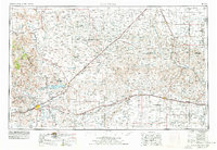
1954 Map of Tucumcari
USGS Topo · Published 1978About this map
The high plains of eastern New Mexico and the Texas Panhandle converge in this detailed mapping of the mid-20th century. Tucumcari serves as a regional hub, shadowed by the prominent Tucumcari Mountain and surrounded by ranching landscape. The development of water infrastructure is central to the area's geography, visible through the Ute Reservoir and Ute Dam on the Canadian River, alongside the Hudson Canal.
Find a feature on this map
69 named features on this map. Tap any name to fly to it.
Don’t see what you’re looking for? This feature index may not catch every label — zoom into the map to look around manually.
Map Details
Editions of this 1954 Tucumcari Map
2 editions found

Other maps of this area

1930 · Tucumcari
USGS Topo · 1:125,000

1934 · Ady
USGS Topo · 1:62,500

1934 · Cliffside
USGS Topo · 1:62,500

1936 · Fourways
USGS Topo · 1:62,500

1936 · Cliffside
USGS Topo · 1:62,500

1936 · Ady
USGS Topo · 1:62,500

1953 · Marsh
USGS Topo · 1:24,000

1953 · Puente
USGS Topo · 1:24,000

1953 · Masterson
USGS Topo · 1:24,000

1953 · Cliffside
USGS Topo · 1:24,000