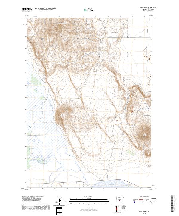
2023 Map of Tuff Butte
USGS Topo · Published 2023About this map
Tuff Butte and Hayes Butte dominate the central topography of this high desert landscape in Lake County. The southern edge of the map features the northern reach of Silver Lake and the sprawling Paulina Marsh, where seasonal water patterns are defined by drainage from Silver Creek, Bunyard Creek, and Murdock Creek. This 2023 survey illustrates the persistent ranching and rural infrastructure of the region, anchored by established routes like Fort Rock Rd and Arrow Gap Rd.
Find a feature on this map
26 named features on this map. Tap any name to fly to it.
Don’t see what you’re looking for? This feature index may not catch every label — zoom into the map to look around manually.
Map Details
Editions of this 2023 Tuff Butte Map
This is the sole edition of this map. No revisions or reprints were ever made.
Other maps of this area

1955 · Crescent
USGS Topo · 1:250,000

1957 · Crescent
USGS Topo · 1:250,000

1958 · Crescent
USGS Topo · 1:250,000

1968 · Silver Lake
USGS Topo · 1:24,000
1968 · Hager Mtn
USGS Topo · 1:24,000

1970 · Crescent
USGS Topo · 1:250,000

1979 · Crescent
USGS Topo · 1:100,000

1981 · Thorn Lake
USGS Topo · 1:24,000

1981 · Lane Lake
USGS Topo · 1:24,000
1981 · Tuff Butte
USGS Topo · 1:24,000