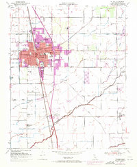
1950 Map of Tulare
USGS Topo · Published 1971About this map
The agricultural hub of Tulare is anchored by the dual transport corridors of the Southern Pacific Railroad and the Atchison Topeka and Santa Fe Railway. This mid-century survey illustrates the town's civic expansion, showing numerous educational facilities like St Aloysius Sch, Garden Ave Sch, and Tulare Western High Sch alongside the sprawling County Fairgrounds. The surrounding San Joaquin Valley landscape is defined by an intricate network of water management, including the Tulare Irrigation District Canal and Bates Slough. Outside the city limits, smaller community nodes like Oakland Colony and the Old Peoples Home appear near aviation sites such as Rankin Airfield and the Tulare Municipal Airport, reflecting the region's post-war infrastructure growth.
Find a feature on this map
72 named features on this map. Tap any name to fly to it.
Don’t see what you’re looking for? This feature index may not catch every label — zoom into the map to look around manually.
Map Details
Editions of this 1950 Tulare Map
2 editions found
Other maps of this area

1925 · Tulare
USGS Topo · 1:31,680

1925 · Tipton
USGS Topo · 1:31,680

1926 · Goshen
USGS Topo · 1:31,680

1926 · Exeter
USGS Topo · 1:31,680

1927 · Cairns Corner
USGS Topo · 1:31,680

1927 · Lake View School
USGS Topo · 1:31,680

1927 · Paige
USGS Topo · 1:31,680

1927 · Visalia
USGS Topo · 1:31,680

1927 · Tulare
USGS Topo · 1:31,680

1928 · Tipton
USGS Topo · 1:31,680