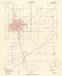
1951 Map of Tulare
USGS Topo · Published 1951About this map
Tulare serves as a dense agricultural and transit hub in this mid-century survey, defined by its extensive network of irrigation infrastructure and educational institutions. The map reveals a town heavily invested in its future, featuring numerous neighborhood schools such as Maple Sch, Central Sch, and Roosevelt Sch, along with the large Union H S campus and a dedicated High School Farm. Outside the city center, the landscape is carved by the Tulare Irrigation District Canal, Elk Bayou, and dozens of named ditches like Prosperity Ditch and Farmers Ditch, which support the surrounding orchards and fields.
Find a feature on this map
62 named features on this map. Tap any name to fly to it.
Don’t see what you’re looking for? This feature index may not catch every label — zoom into the map to look around manually.
Map Details
Editions of this 1951 Tulare Map
2 editions found
Other maps of this area

1925 · Tulare
USGS Topo · 1:31,680

1925 · Tipton
USGS Topo · 1:31,680

1926 · Goshen
USGS Topo · 1:31,680

1926 · Exeter
USGS Topo · 1:31,680

1927 · Cairns Corner
USGS Topo · 1:31,680

1927 · Lake View School
USGS Topo · 1:31,680

1927 · Paige
USGS Topo · 1:31,680

1927 · Visalia
USGS Topo · 1:31,680

1927 · Tulare
USGS Topo · 1:31,680

1928 · Tipton
USGS Topo · 1:31,680