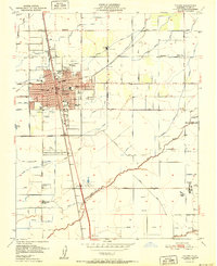
1951 Map of Tulare
USGS Topo · Published 1951About this map
Tulare serves as a significant central valley hub where the Southern Pacific and Atchison Topeka and Santa Fe railroads intersect, driving the region's mid-century development. The map reveals an intricate network of irrigation canals, such as the Tulare Irrigation District Canal and Kaweah Canal, which sustained the surrounding agricultural landscape. This infrastructure supported specialized sites like the High School Farm and a local Winery, highlighting the area's deep-rooted connection to large-scale farming and food production.
Find a feature on this map
67 named features on this map. Tap any name to fly to it.
Don’t see what you’re looking for? This feature index may not catch every label — zoom into the map to look around manually.
Map Details
Editions of this 1951 Tulare Map
2 editions found
Other maps of this area

1925 · Tulare
USGS Topo · 1:31,680

1925 · Tipton
USGS Topo · 1:31,680

1926 · Goshen
USGS Topo · 1:31,680

1926 · Exeter
USGS Topo · 1:31,680

1927 · Cairns Corner
USGS Topo · 1:31,680

1927 · Lake View School
USGS Topo · 1:31,680

1927 · Paige
USGS Topo · 1:31,680

1927 · Visalia
USGS Topo · 1:31,680

1927 · Tulare
USGS Topo · 1:31,680

1928 · Tipton
USGS Topo · 1:31,680