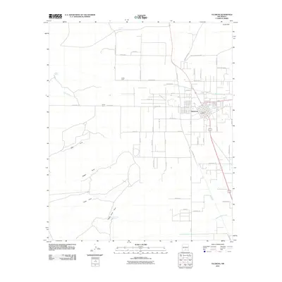
2010 Map of Tularosa
USGS Topo · Published 2010About this map
Tularosa sits at the heart of this high-desert landscape, where the organized grid of the town meets a vast network of drainage systems and springs. The settlement is defined by its relationship with Tularosa Creek, which flows from the east toward the town center, where the Tularosa Post Office remains a central landmark. The surrounding terrain is marked by a series of significant draws, including Allen Draw, Reagan Draw, and Gullez Draw, which illustrate the complex desert hydrology of the Tularosa Basin. To the north, the Coyote Hills rise above a landscape dotted with isolated water sources like Lomitas Spring and Brazel Spring. Local agriculture and ranching history are evident in the presence of Purday Ranch and a dense network of farm-to-market roads, such as Tularosa Farm Rd and Old Champion Farm Rd, reflecting the area's long-standing reliance on carefully managed desert water and rural connectivity.
Find a feature on this map
50 named features on this map. Tap any name to fly to it.
Don’t see what you’re looking for? This feature index may not catch every label — zoom into the map to look around manually.
Map Details
Editions of this 2010 Tularosa Map
This is the sole edition of this map. No revisions or reprints were ever made.
Other maps of this area

1916 · Tularosa
USGS Topo · 1:125,000

1916 · Point Of Sands
USGS Topo · 1:125,000

1948 · Tularosa
USGS Topo · 1:62,500

1948 · Holloman
USGS Topo · 1:62,500

1950 · Alamogordo
USGS Topo · 1:62,500

1950 · Mescalero
USGS Topo · 1:62,500

1954 · Carlsbad
USGS Topo · 1:250,000

1954 · Tularosa
USGS Topo · 1:250,000

1955 · Las Cruces
USGS Topo · 1:250,000

1955 · Roswell
USGS Topo · 1:250,000