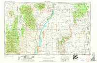
1954 Map of Tularosa
USGS Topo · Published 1963About this map
Elephant Butte Reservoir and Caballo Reservoir dominate the central corridor of this survey, where the Rio Grande flows through the high desert of Sierra and Socorro counties. The map reflects a mid-century landscape where early mining settlements like Chloride and Winston in the Black Range persist alongside modern military installations. Large swaths of the eastern terrain are occupied by the Alamogordo Bombing Range and White Sands Proving Ground, illustrating the region's importance to national defense and aerospace testing during the Cold War. In contrast to these restricted zones, the Bosque del Apache National Wildlife Refuge and Cibola National Forest preserve the natural environment. Notable for local history is the identified San Marcial (site), once a significant town along the Atchison Topeka and Santa Fe railroad, and the transition of Hot Springs to Truth or Consequences.
Find a feature on this map
55 named features on this map. Tap any name to fly to it.
Don’t see what you’re looking for? This feature index may not catch every label — zoom into the map to look around manually.
Map Details
Editions of this 1954 Tularosa Map
4 editions found

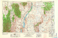
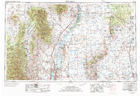
Other maps of this area

1906 · Socorro
USGS Topo · 1:62,500

1909 · Silver City
USGS Topo · 1:125,000

1911 · Alum Mountain
USGS Topo · 1:125,000

1913 · Alum Mountain
USGS Topo · 1:125,000

1916 · La Joya
USGS Topo · 1:125,000

1916 · Tonuco
USGS Topo · 1:125,000

1916 · Salinas Peak
USGS Topo · 1:125,000

1916 · Tularosa
USGS Topo · 1:125,000

1916 · Point Of Sands
USGS Topo · 1:125,000

1918 · Pelona
USGS Topo · 1:125,000