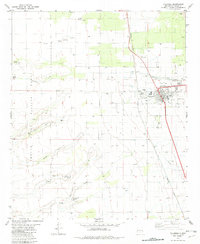
1982 Map of Tularosa
USGS Topo · Published 1982About this map
The high desert landscape of Tularosa is defined by its careful management of water and its proximity to federal military installations. In the early 1980s, the village is shown concentrated along the Southern Pacific railroad line, featuring local landmarks such as the Rodeo Ground, Athletic Field, and educational facilities like the High Sch and Jr High Sch. The importance of irrigation is evident through the Tularosa Ditch and a complex Aqueduct system that channels resources through the arid terrain.
Find a feature on this map
27 named features on this map. Tap any name to fly to it.
Don’t see what you’re looking for? This feature index may not catch every label — zoom into the map to look around manually.
Map Details
Editions of this 1982 Tularosa Map
This is the sole edition of this map. No revisions or reprints were ever made.
Other maps of this area

1916 · Tularosa
USGS Topo · 1:125,000

1916 · Point Of Sands
USGS Topo · 1:125,000

1948 · Tularosa
USGS Topo · 1:62,500

1948 · Holloman
USGS Topo · 1:62,500

1950 · Alamogordo
USGS Topo · 1:62,500

1950 · Mescalero
USGS Topo · 1:62,500

1954 · Carlsbad
USGS Topo · 1:250,000

1954 · Tularosa
USGS Topo · 1:250,000

1955 · Las Cruces
USGS Topo · 1:250,000

1955 · Roswell
USGS Topo · 1:250,000