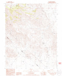
1987 Map of Tule Canyon
USGS Topo · Published 1987About this map
Tule Canyon dominates the high desert terrain where the Nevada-California state line meets the Esmeralda and Inyo County border. This late-1980s topographic record details a landscape defined by its scarce water sources and mineral exploration. Crucial desert landmarks such as Walker Spring, Wild Rose Spring, and Roosevelt Well appear alongside the drainages of Cottonwood Creek and Alum Creek. The presence of the historic Von Schmidt Line provides a tangible look at the surveying legacy used to define the western state boundaries. Evidence of the region’s prospecting history is found in numerous scattered prospects and isolated mines throughout Slate Ridge and the Lida Valley, reflecting the enduring interest in the mineral wealth of the high Great Basin summits like Tule Summit.
Find a feature on this map
20 named features on this map. Tap any name to fly to it.
Don’t see what you’re looking for? This feature index may not catch every label — zoom into the map to look around manually.
Map Details
Editions of this 1987 Tule Canyon Map
This is the sole edition of this map. No revisions or reprints were ever made.
Other maps of this area

1908 · Lida
USGS Topo · 1:250,000

1913 · Lida
USGS Topo · 1:250,000

1954 · Goldfield
USGS Topo · 1:250,000

1955 · Goldfield
USGS Topo · 1:250,000

1957 · Magruder Mtn
USGS Topo · 1:62,500

1957 · Ubehebe Crater
USGS Topo · 1:62,500

1958 · Goldfield
USGS Topo · 1:250,000

1958 · Last Chance Range
USGS Topo · 1:62,500

1962 · Goldfield
USGS Topo · 1:250,000

1968 · Lida
USGS Topo · 1:24,000