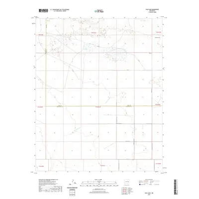
2020 Map of Tule Lake
USGS Topo · Published 2020About this map
The high plains of eastern New Mexico are defined by subtle depressions and seasonal drainages in this 2020 survey of the borderlands between Curry and Roosevelt counties. The eponymous Tule Lake and Little Tule Lake serve as the primary hydrological landmarks, collecting runoff in an otherwise arid landscape. These shallow basins are complemented by the winding Cañada del Tule and Fiddlers Draw, which trace the natural flow of water across the Llano Estacado. The map reveals a highly structured rural landscape dictated by the Public Land Survey System, with the Base Line and the county boundary—labeled Curry Co Roosevelt Co—serving as the anchors for the regional grid. The road network, including Sun-Dale-Valley-Rd and numerous Roosevelt Road designations, follows these section lines, illustrating the intersection of modern logistics and early territorial division.
Find a feature on this map
28 named features on this map. Tap any name to fly to it.
Don’t see what you’re looking for? This feature index may not catch every label — zoom into the map to look around manually.
Map Details
Editions of this 2020 Tule Lake Map
This is the sole edition of this map. No revisions or reprints were ever made.
Other maps of this area

1954 · Clovis
USGS Topo · 1:250,000

1957 · Melrose
USGS Topo · 1:62,500

1958 · Clovis
USGS Topo · 1:250,000

1972 · Melrose East
USGS Topo · 1:24,000

1973 · Floyd
USGS Topo · 1:24,000

1973 · Krider
USGS Topo · 1:24,000

1973 · Melrose West
USGS Topo · 1:24,000

1973 · Tule Lake
USGS Topo · 1:24,000

1973 · Gammil Well NE
USGS Topo · 1:24,000

1973 · Upton
USGS Topo · 1:24,000