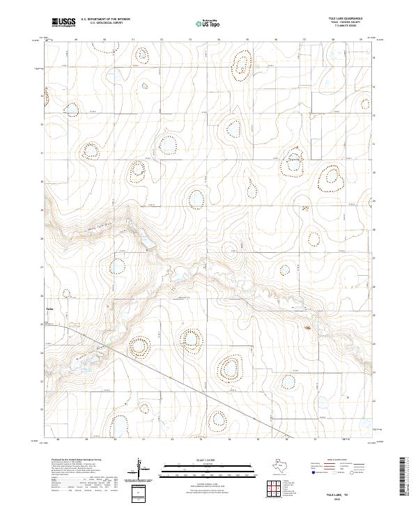
2022 Map of Tule Lake
USGS Topo · Published 2022About this map
Tulia sits on the western edge of this High Plains landscape, where the flat agricultural terrain is dramatically interrupted by the erosional features of the North Tule Draw and Middle Tule Draw. These drainage patterns converge toward the center of the map, feeding into Tule Lake and the Bill Bivens Reservoir. The water management on this part of the Llano Estacado is evident in the engineered containment of these draws, which eventually transition into the eastward-flowing Tule Cr.
Find a feature on this map
25 named features on this map. Tap any name to fly to it.
Don’t see what you’re looking for? This feature index may not catch every label — zoom into the map to look around manually.
Map Details
Editions of this 2022 Tule Lake Map
This is the sole edition of this map. No revisions or reprints were ever made.
Other maps of this area

1954 · Plainview
USGS Topo · 1:250,000

1958 · Plainview
USGS Topo · 1:250,000

1965 · Edmonson NE
USGS Topo · 1:24,000

1965 · Tulia
USGS Topo · 1:24,000

1965 · Happy
USGS Topo · 1:24,000

1968 · Tule Lake
USGS Topo · 1:24,000

1969 · Love
USGS Topo · 1:24,000

1969 · Jackson Hill
USGS Topo · 1:24,000

1969 · Claytonville
USGS Topo · 1:24,000

1969 · Tule Lake NW
USGS Topo · 1:24,000