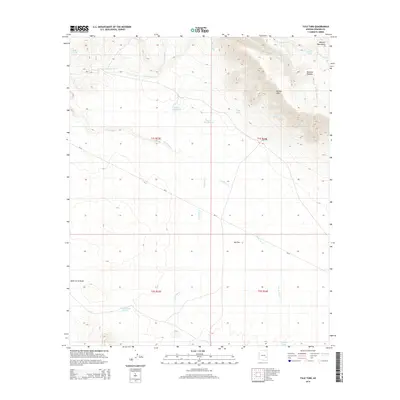
2014 Map of Tule Tubs
USGS Topo · Published 2014About this map
Nantac Rim and the Natanes Plateau dominate the northeastern landscape of this Graham County region, where sharp elevation changes define the transition from high desert plateaus to the expansive Ash Flat. Water management is the primary human imprint on this arid terrain, evidenced by a network of localized catchments such as Soldier Hole Tank, Hooker Gap Charco, and the aptly named Arsenic Tank. These features, along with Pasture Five Charco, suggest a history of cattle ranching and livestock movement in an environment where reliable water sources like Tule Springs are rare.
Find a feature on this map
23 named features on this map. Tap any name to fly to it.
Don’t see what you’re looking for? This feature index may not catch every label — zoom into the map to look around manually.
Map Details
Editions of this 2014 Tule Tubs Map
This is the sole edition of this map. No revisions or reprints were ever made.
Other maps of this area

1954 · Clifton
USGS Topo · 1:250,000

1954 · Mesa
USGS Topo · 1:250,000

1957 · Mesa
USGS Topo · 1:250,000

1957 · Clifton
USGS Topo · 1:250,000

1958 · Clifton
USGS Topo · 1:250,000

1958 · Mesa
USGS Topo · 1:250,000

1960 · Mesa
USGS Topo · 1:250,000

1960 · Bylas
USGS Topo · 1:62,500

1960 · Fort Thomas
USGS Topo · 1:62,500

1962 · Clifton
USGS Topo · 1:250,000