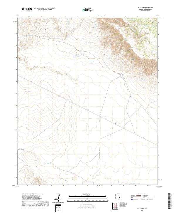
2021 Map of Tule Tubs
USGS Topo · Published 2021About this map
Nantac Rim and the Natanes Plateau dominate this high-desert landscape in Graham County, where elevation drops sharply into the expansive Ash Flat to the south. This remote Arizona terrain is defined by a complex network of seasonal drainages and man-made water catchments essential for ranching and livestock in an arid environment. Named water sources like Hooker Gap Charco, Arsenic Tank, and Tule Springs punctuate the landscape, serving as vital landmarks across the open range. The topography is further etched by deep draws and creeks, including Beef Corral Draw and Little Rocky Cr, while the namesake Tule Tubs sit beneath the towering cliffs of the plateau. Co RD 8 provides the primary traverse through this territory, tracing the transition from high mountain rims to the flat basin floor.
Find a feature on this map
23 named features on this map. Tap any name to fly to it.
Don’t see what you’re looking for? This feature index may not catch every label — zoom into the map to look around manually.
Map Details
Editions of this 2021 Tule Tubs Map
This is the sole edition of this map. No revisions or reprints were ever made.
Other maps of this area

1954 · Clifton
USGS Topo · 1:250,000

1954 · Mesa
USGS Topo · 1:250,000

1957 · Mesa
USGS Topo · 1:250,000

1957 · Clifton
USGS Topo · 1:250,000

1958 · Clifton
USGS Topo · 1:250,000

1958 · Mesa
USGS Topo · 1:250,000

1960 · Mesa
USGS Topo · 1:250,000

1960 · Bylas
USGS Topo · 1:62,500

1960 · Fort Thomas
USGS Topo · 1:62,500

1962 · Clifton
USGS Topo · 1:250,000