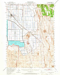
1951 Map of Tulelake
USGS Topo · Published 1965About this map
Tulelake serves as the primary hub in this 1951 survey, situated at the crossroads of the Southern Pacific and Great Northern railroads. The landscape is defined by the massive reclamation and wildlife management efforts of the Tule Lake National Wildlife Refuge, where the Tule Lake Sump and Copic Bay dominate the basin. To the south, the terrain transitions into the volcanic landscape of the Lava Beds National Monument, featuring landmarks like Hospital Rock and Prisoners Rock.
Find a feature on this map
72 named features on this map. Tap any name to fly to it.
Don’t see what you’re looking for? This feature index may not catch every label — zoom into the map to look around manually.
Map Details
Editions of this 1951 Tulelake Map
4 editions found
Other maps of this area

1886 · Modoc Lava Bed
USGS Topo · 1:250,000

1889 · Klamath
USGS Topo · 1:250,000

1892 · Modoc Lava-Bed
USGS Topo · 1:250,000

1894 · Klamath
USGS Topo · 1:250,000

1950 · Mt. Dome
USGS Topo · 1:62,500

1951 · Clear Lake Reservoir
USGS Topo · 1:62,500

1951 · Tulelake
USGS Topo · 1:62,500

1952 · Timber Mountain
USGS Topo · 1:62,500

1952 · Hackamore
USGS Topo · 1:62,500

1952 · Medicine Lake
USGS Topo · 1:62,500