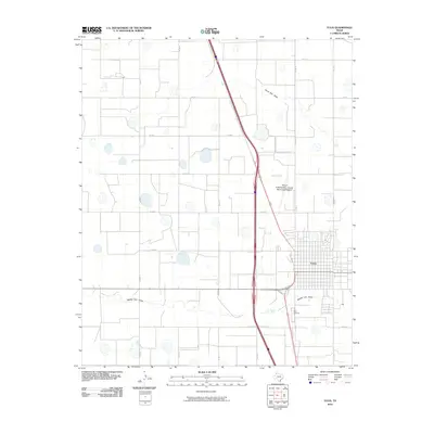
2010 Map of Tulia
USGS Topo · Published 2010About this map
Tulia serves as the focal point of this Panhandle landscape, where the town's grid is bisected by major transportation corridors and surrounded by a vast network of section roads. The map reveals a high-plains geography defined by ephemeral drainage patterns, most notably North Tule Draw and Middle Tule Draw, which cut across the terrain. Public and local infrastructure is well-documented, from the City of Tulia/Swisher County Municipal Airport north of the residential center to Rose Cemetery on the southern outskirts. This 2010 update reflects the modern alignment of Interstate 27 alongside older routes like Hillcrest Rd, showing how the town has maintained its role as a regional hub for Swisher County even as transportation technology evolved.
Find a feature on this map
20 named features on this map. Tap any name to fly to it.
Don’t see what you’re looking for? This feature index may not catch every label — zoom into the map to look around manually.
Map Details
Editions of this 2010 Tulia Map
This is the sole edition of this map. No revisions or reprints were ever made.
Other maps of this area

1954 · Plainview
USGS Topo · 1:250,000

1958 · Plainview
USGS Topo · 1:250,000

1965 · Edmonson NE
USGS Topo · 1:24,000

1965 · Tulia
USGS Topo · 1:24,000

1965 · Lakeview
USGS Topo · 1:24,000

1965 · Happy
USGS Topo · 1:24,000

1965 · Center Plains School
USGS Topo · 1:24,000

1966 · Tulia NW
USGS Topo · 1:24,000

1968 · Tule Lake
USGS Topo · 1:24,000

1969 · Tule Lake NW
USGS Topo · 1:24,000