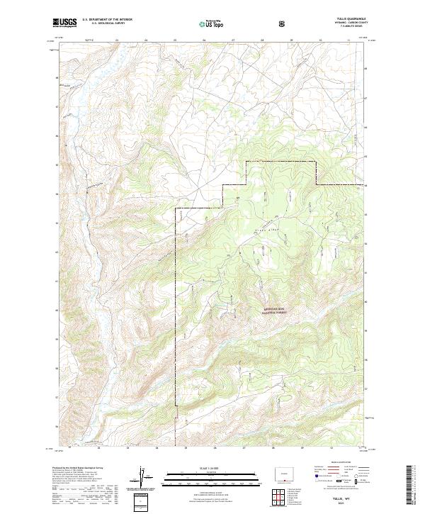
2021 Map of Tullis
USGS Topo · Published 2021About this map
Medicine Bow National Forest dominates the southern half of this landscape, where high-altitude drainages carve through the Wyoming wilderness. The topography is defined by the sharp descent from Green Ridge into the complex network of Hell Canyon and the surrounding draws. Water is the primary architect of the terrain, with Savery Cr flowing through the western sections and the major tributaries of Big Sandstone Cr and Little Sandstone Cr reaching across the forest floor. Primitive routes like Browns Hill Rd and Sage Creek Rd provide the only access to these elevations. This area is characterized by its resource-related nomenclature, such as Coal Gulch and Hayrack Draw, suggesting a history of early ranching and mineral exploration in Carbon County.
Find a feature on this map
22 named features on this map. Tap any name to fly to it.
Don’t see what you’re looking for? This feature index may not catch every label — zoom into the map to look around manually.
Map Details
Editions of this 2021 Tullis Map
This is the sole edition of this map. No revisions or reprints were ever made.
Other maps of this area

1932 · Savery
USGS Topo · 1:96,000

1940 · Savery
USGS Topo · 1:125,000

1954 · Rawlins
USGS Topo · 1:250,000

1958 · Rawlins
USGS Topo · 1:250,000

1961 · Divide Peak
USGS Topo · 1:24,000
1961 · Savery
USGS Topo · 1:24,000
1961 · Browns Hill
USGS Topo · 1:24,000

1961 · Ketchum Buttes
USGS Topo · 1:24,000

1961 · Grieve Reservoir
USGS Topo · 1:24,000
1961 · Singer Peak
USGS Topo · 1:24,000