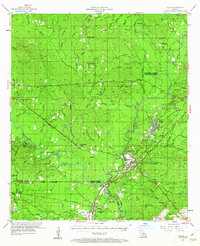
1954 Map of Tullos
USGS Topo · Published 1962About this map
The Dugdemona River meanders through the central lowlands of central Louisiana, anchoring a landscape defined by the intersection of the lumber and oil industries in the mid-1950s. The timber town of Urania and the nearby settlement of Tullos serve as primary hubs along the Missouri Pacific railroad line, which cuts diagonally across the terrain. This era of resource extraction is evident in the cluster of Oil Wells scattered near Georgetown and the extensive reaching of the Kisatchie National Forest boundaries into the southern portions of the map.
Find a feature on this map
101 named features on this map. Tap any name to fly to it.
Don’t see what you’re looking for? This feature index may not catch every label — zoom into the map to look around manually.
Map Details
Editions of this 1954 Tullos Map
4 editions found

Other maps of this area

1932 · Colfax NE
USGS Topo · 1:31,680

1936 · Colfax
USGS Topo · 1:62,500

1936 · Pollock
USGS Topo · 1:62,500

1940 · Columbia
USGS Topo · 1:62,500

1941 · Jena
USGS Topo · 1:62,500

1941 · Pollock
USGS Topo · 1:62,500

1949 · Jonesboro
USGS Topo · 1:62,500

1950 · Jonesboro
USGS Topo · 1:62,500

1950 · Winnfield
USGS Topo · 1:62,500

1951 · Winnfield
USGS Topo · 1:62,500