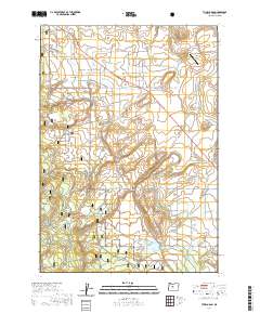
2020 Map of Tumalo Dam
USGS Topo · Published 2020About this map
Tumalo Dam and the Upper Tumalo Reservoir anchor this High Desert landscape, where water management is the primary driver of development. The area is defined by an intricate network of irrigation infrastructure, including the Columbia Southern Canal, the Tumalo Feed Canal, and smaller waterways like the Plainview Ditch and Snow Cr Ditch. This reliance on channeled water is evident in the transition from the arid expanse of Bull Flat to the managed greenery of local estates.
Find a feature on this map
59 named features on this map. Tap any name to fly to it.
Don’t see what you’re looking for? This feature index may not catch every label — zoom into the map to look around manually.
Map Details
Editions of this 2020 Tumalo Dam Map
This is the sole edition of this map. No revisions or reprints were ever made.
Other maps of this area

1926 · Bend
USGS Topo · 1:125,000

1929 · Bend
USGS Topo · 1:125,000

1929 · Three Sisters
USGS Topo · 1:125,000

1932 · Three Sisters
USGS Topo · 1:125,000

1955 · Bend
USGS Topo · 1:250,000

1957 · Bend
USGS Topo · 1:250,000

1958 · Bend
USGS Topo · 1:250,000

1959 · Broken Top
USGS Topo · 1:62,500

1959 · Sisters
USGS Topo · 1:62,500
1962 · Bend
USGS Topo · 1:24,000