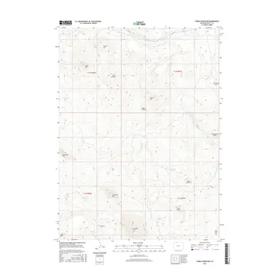
2016 Map of Tumble Mountain
USGS Topo · Published 2016About this map
The Little Snake River meanders through the northern reaches of this Colorado high-country landscape, where the elevation rises steeply toward significant peaks. In the southern half of the quadrangle, water management is evident at Lake Fork Reservoir and Boyer Reservoir, which sit amidst a series of prominent landforms including Tumble Mountain and Circle Ridge. The terrain is defined by its massive summits, notably W Gibraltar Peak and E Gibraltar Peak, which tower over the surrounding drainage basins of Willow Cr and Beaver Cr. A network of unpaved roads such as Co RD 129a provides access through this drainage-rich environment. To the east, distinctive geological features like Gold Blossom Rocks and Pine Scope Hill overlook the basin, while the name Maria Bottoms suggests the historical importance of the flatter lands adjacent to the seasonal watercourses.
Find a feature on this map
32 named features on this map. Tap any name to fly to it.
Don’t see what you’re looking for? This feature index may not catch every label — zoom into the map to look around manually.
Map Details
Editions of this 2016 Tumble Mountain Map
This is the sole edition of this map. No revisions or reprints were ever made.
Other maps of this area

1932 · Savery
USGS Topo · 1:96,000

1940 · Savery
USGS Topo · 1:125,000

1954 · Rawlins
USGS Topo · 1:250,000

1954 · Craig
USGS Topo · 1:250,000

1957 · Craig
USGS Topo · 1:250,000

1958 · Rawlins
USGS Topo · 1:250,000

1958 · Craig
USGS Topo · 1:250,000

1960 · Craig
USGS Topo · 1:250,000

1961 · Grieve Reservoir
USGS Topo · 1:24,000
1961 · Fletcher Peak
USGS Topo · 1:24,000