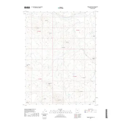
2019 Map of Tumble Mountain
USGS Topo · Published 2019About this map
The Little Snake River meanders across the northern reaches of this landscape in Routt County, marking a stark contrast to the surrounding high-altitude terrain. This region is defined by a series of prominent summits and ridges, including Tumble Mtn, Columbus Mtn, and the distinctive West Gibraltar Peak and East Gibraltar Peak. The drainage patterns of Willow Cr and Beaver Cr reveal the complex hydraulic network of the area, punctuated by the Lake Fork Reservoir and Boyer Reservoir.
Find a feature on this map
32 named features on this map. Tap any name to fly to it.
Don’t see what you’re looking for? This feature index may not catch every label — zoom into the map to look around manually.
Map Details
Editions of this 2019 Tumble Mountain Map
This is the sole edition of this map. No revisions or reprints were ever made.
Other maps of this area

1932 · Savery
USGS Topo · 1:96,000

1940 · Savery
USGS Topo · 1:125,000

1954 · Rawlins
USGS Topo · 1:250,000

1954 · Craig
USGS Topo · 1:250,000

1957 · Craig
USGS Topo · 1:250,000

1958 · Rawlins
USGS Topo · 1:250,000

1958 · Craig
USGS Topo · 1:250,000

1960 · Craig
USGS Topo · 1:250,000

1961 · Grieve Reservoir
USGS Topo · 1:24,000
1961 · Fletcher Peak
USGS Topo · 1:24,000