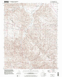
2000 Map of Tumey Hills
USGS Topo · Published 2002About this map
The boundary between Fresno and San Benito counties runs through this arid California interior, a landscape defined by the drainage of Panoche Creek and Tumey Gulch. This 2000 edition shows a territory of resource extraction and survey benchmarks, where the northern Panoche Hills meet the southern Tumey Hills. The rugged topography is punctuated by numerous Oil Wells and Prospects, particularly in the southern Vallecitos region, indicating a legacy of petroleum exploration and mining interest in the Diablo Range foothills.
Find a feature on this map
15 named features on this map. Tap any name to fly to it.
Don’t see what you’re looking for? This feature index may not catch every label — zoom into the map to look around manually.
Map Details
Editions of this 2000 Tumey Hills Map
2 editions found
Other maps of this area

1913 · Panoche
USGS Topo · 1:125,000

1915 · Priest Valley
USGS Topo · 1:125,000

1921 · Tierra Loma School
USGS Topo · 1:31,680

1922 · Chaney Ranch
USGS Topo · 1:31,680

1923 · Tierra Loma School
USGS Topo · 1:31,680

1923 · Monocline Ridge
USGS Topo · 1:31,680

1943 · New Idria
USGS Topo · 1:62,500

1943 · Hernandez Valley
USGS Topo · 1:62,500

1944 · Hernandez Valley
USGS Topo · 1:62,500

1944 · Panoche Valley
USGS Topo · 1:62,500