
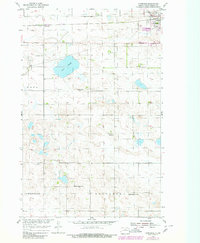
1954 Map of Tunbridge
USGS Topo · Published 1956About this map
The Great Northern railroad corridor defines the northern landscape of this Pierce County survey, connecting the settlement of Tunbridge to the western outskirts of Rugby. This agricultural region is characterized by prairie potholes and wetlands, most notably the wide expanse of Sand Slough. The rural economy and community structure of the mid-1950s are evident in the distribution of one-room schoolhouses and local parishes.
Find a feature on this map
14 named features on this map. Tap any name to fly to it.
Don’t see what you’re looking for? This feature index may not catch every label — zoom into the map to look around manually.
Map Details
Editions of this 1954 Tunbridge Map
2 editions found
Other maps of this area

1953 · Devils Lake
USGS Topo · 1:250,000

1954 · Berwick
USGS Topo · 1:24,000

1954 · Round Lake
USGS Topo · 1:24,000

1954 · Rugby NW
USGS Topo · 1:24,000

1954 · Leverich
USGS Topo · 1:24,000

1954 · Minot
USGS Topo · 1:250,000

1955 · Rugby
USGS Topo · 1:24,000

1956 · Devils Lake
USGS Topo · 1:250,000

1958 · Minot
USGS Topo · 1:250,000
1958 · Balta NW
USGS Topo · 1:24,000