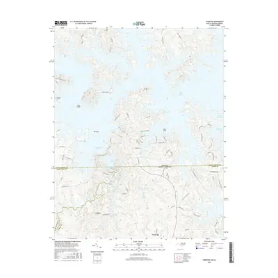
2016 Map of Tungsten
USGS Topo · Published 2016About this map
John H. Kerr Reservoir dominates this landscape along the border of Virginia and North Carolina, where its winding shoreline creates numerous peninsulas and islands. To the south, the settlement of Tungsten sits near the Tungsten Mine Rd, a name reflecting the historical industrial activity of the Hamme Tungsten District. The terrain transition between Mecklenburg County, Virginia, and the North Carolina counties of Granville and Vance is marked by a complex network of waterways, including Island Cr Reservoir and the flowing channels of Island Creek. Local history is visible in features such as Fields Cem and the small communities of Townsville and Woodworth. This map provides a clear view of the area's modern infrastructure, from Merifield Airport to the numerous residential roads like Broken Anchor Blvd and Serenity Point Rd that have developed along the reservoir's edge.
Find a feature on this map
78 named features on this map. Tap any name to fly to it.
Don’t see what you’re looking for? This feature index may not catch every label — zoom into the map to look around manually.
Map Details
Editions of this 2016 Tungsten Map
This is the sole edition of this map. No revisions or reprints were ever made.
Other maps of this area

1941 · Clarksville
USGS Topo · 1:48,000

1943 · Clarksville
USGS Topo · 1:62,500

1953 · Oxford
USGS Topo · 1:62,500

1953 · Greensboro
USGS Topo · 1:250,000

1954 · Greensboro
USGS Topo · 1:250,000

1955 · Boydton
USGS Topo · 1:62,500

1957 · Clarksville
USGS Topo · 1:62,500

1962 · Greensboro
USGS Topo · 1:250,000

1966 · Greensboro
USGS Topo · 1:250,000

1966 · Oxford
USGS Topo · 1:62,500