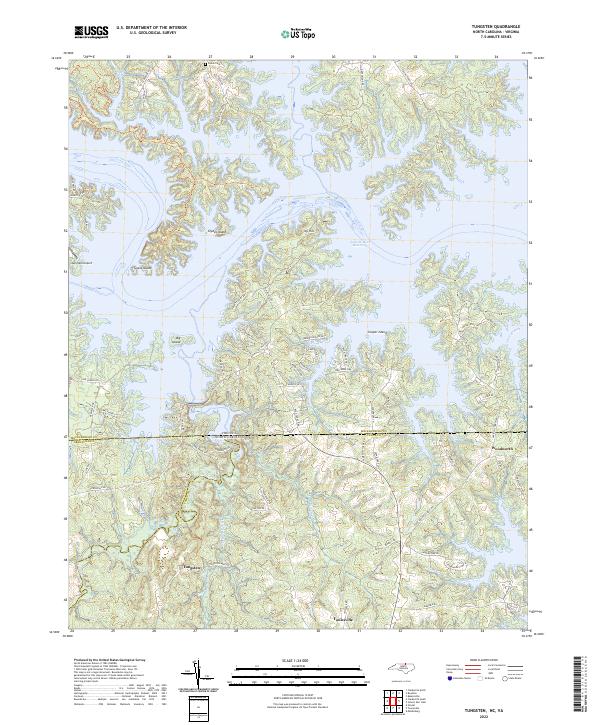
2022 Map of Tungsten
USGS Topo · Published 2022About this map
The John H. Kerr Reservoir dominates this borderland between North Carolina and Virginia, where the flooded landscape of the Roanoke River basin creates a complex network of inlets and islands. Along the southern shores, the settlement of Tungsten sits near Island Creek, marking an area with a history tied to local mineral extraction. The map details the transition from the rolling woodlands of Vance and Granville Counties to the expansive waters of the reservoir, highlighting numerous named landforms that survived the flooding, such as Clydes Island, Ivy Hill, and Cooper Island.
Find a feature on this map
74 named features on this map. Tap any name to fly to it.
Don’t see what you’re looking for? This feature index may not catch every label — zoom into the map to look around manually.
Map Details
Editions of this 2022 Tungsten Map
This is the sole edition of this map. No revisions or reprints were ever made.
Other maps of this area

1941 · Clarksville
USGS Topo · 1:48,000

1943 · Clarksville
USGS Topo · 1:62,500

1953 · Oxford
USGS Topo · 1:62,500

1953 · Greensboro
USGS Topo · 1:250,000

1954 · Greensboro
USGS Topo · 1:250,000

1955 · Boydton
USGS Topo · 1:62,500

1957 · Clarksville
USGS Topo · 1:62,500

1962 · Greensboro
USGS Topo · 1:250,000

1966 · Greensboro
USGS Topo · 1:250,000

1966 · Oxford
USGS Topo · 1:62,500