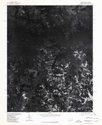
1977 Map of Tungsten
USGS Topo · Published 1978About this map
Tungsten, North Carolina, is the focal point of this 1970s orthophotoquad, which reveals a landscape defined by the intricate fingers of the John H Kerr Reservoir. Unlike traditional line-drawn topographic maps, this aerial imagery, rectified by the Geological Survey and Soil Conservation Service, provides a raw view of the dense forests and agricultural clearings that bordered the reservoir's south shore in the late twentieth century. The dendritic pattern of the water's edge reaches deep into the terrain, following the path of Island Creek and its tributaries. This specific survey type is particularly valuable for researchers tracing land use and property boundaries of the era, as it shows the exact footprint of forest cover and shoreline development surrounding the small settlement of Tungsten at a time when the surrounding Vance County region was heavily influenced by the reservoir's presence.
Find a feature on this map
4 named features on this map. Tap any name to fly to it.
Don’t see what you’re looking for? This feature index may not catch every label — zoom into the map to look around manually.
Map Details
Editions of this 1977 Tungsten Map
This is the sole edition of this map. No revisions or reprints were ever made.
Other maps of this area

1941 · Clarksville
USGS Topo · 1:48,000

1943 · Clarksville
USGS Topo · 1:62,500

1953 · Oxford
USGS Topo · 1:62,500

1953 · Greensboro
USGS Topo · 1:250,000

1954 · Greensboro
USGS Topo · 1:250,000

1955 · Boydton
USGS Topo · 1:62,500

1957 · Clarksville
USGS Topo · 1:62,500

1962 · Greensboro
USGS Topo · 1:250,000

1966 · Greensboro
USGS Topo · 1:250,000

1966 · Oxford
USGS Topo · 1:62,500