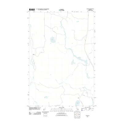
2011 Map of Tunis
USGS Topo · Published 2011About this map
The West Branch Net River meanders through this remote portion of Baraga County, defining a landscape dominated by complex waterways and timber-access routes. The small settlement of Tunis serves as a primary reference point near the western edge of the map, situated along the Perch River. To the southeast, the railroad-linked history of the area is evident at Parks Siding, a location connected to the broader region via Wide Waters Rd and Cable Lake Rd. The map reveals a high density of wetlands and significant water bodies, including May Lake, Saline Lake, and the expansive Net River Flooding. Numerous secondary roads such as Ford Rd and May Lake Rd crisscross the terrain, suggesting a pattern of land use tied to the Northwoods' natural resources. Small-scale industrial activity is noted at a solitary Pit in the northern section, while numerous creeks like Reservoir Creek and Tracy Creek feed into the Net River system.
Find a feature on this map
22 named features on this map. Tap any name to fly to it.
Don’t see what you’re looking for? This feature index may not catch every label — zoom into the map to look around manually.
Map Details
Editions of this 2011 Tunis Map
This is the sole edition of this map. No revisions or reprints were ever made.
Other maps of this area

1895 · Ned Lake
USGS Topo · 1:62,500

1895 · Perch Lake
USGS Topo · 1:62,500

1954 · Perch Lake
USGS Topo · 1:62,500

1954 · Sidnaw
USGS Topo · 1:62,500

1955 · Ned Lake
USGS Topo · 1:62,500

1955 · Herman
USGS Topo · 1:62,500

1958 · Iron River
USGS Topo · 1:250,000

1960 · Iron River
USGS Topo · 1:250,000

1961 · Iron River
USGS Topo · 1:250,000

1967 · Iron River
USGS Topo · 1:250,000