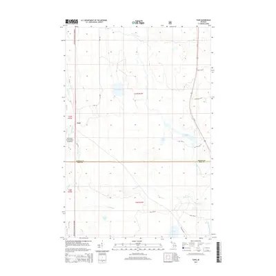
2014 Map of Tunis
USGS Topo · Published 2014About this map
The Ottawa National Forest dominates this section of the Upper Peninsula, where the landscape is defined by the complex hydrology of the Net River system. The settlement of Tunis serves as a small waypoint along Tunis Rd, situated near the headwaters of the Perch River. This area is characterized by a high density of water features and wetlands, including Dead Slough and Net River Flooding, indicating a history of water management and forest drainage. Local transportation is facilitated by forestry routes such as Ford Rd and Cable Lake Rd, which connect remote hunting and fishing grounds like May Lake, Saine Lake, and Herbs Lake. The boundary between Baraga County and Iron County cuts horizontally across the southern half of the sheet, dividing a region primarily focused on timber and resource management, as evidenced by the Pit located in the northern reaches.
Find a feature on this map
32 named features on this map. Tap any name to fly to it.
Don’t see what you’re looking for? This feature index may not catch every label — zoom into the map to look around manually.
Map Details
Editions of this 2014 Tunis Map
This is the sole edition of this map. No revisions or reprints were ever made.
Other maps of this area

1895 · Ned Lake
USGS Topo · 1:62,500

1895 · Perch Lake
USGS Topo · 1:62,500

1954 · Perch Lake
USGS Topo · 1:62,500

1954 · Sidnaw
USGS Topo · 1:62,500

1955 · Ned Lake
USGS Topo · 1:62,500

1955 · Herman
USGS Topo · 1:62,500

1958 · Iron River
USGS Topo · 1:250,000

1960 · Iron River
USGS Topo · 1:250,000

1961 · Iron River
USGS Topo · 1:250,000

1967 · Iron River
USGS Topo · 1:250,000