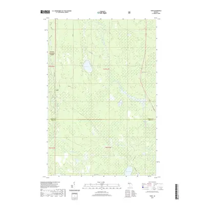
2019 Map of Tunis
USGS Topo · Published 2019About this map
Tunis marks a small point of settlement within the expansive timberlands and wetlands at the border of Baraga and Iron counties. The landscape is defined by the winding course of the West Branch Net River and its various tributaries, including Barley Cr and Reservoir Cr. This area, situated within the Ottawa National Forest, features a distinct hydrological pattern of sloughs and lakes, such as Dead Slough and May Lake. The road network, comprising routes like Ford Rd and Net River Dam Rd, reveals the infrastructure necessary for managing this forest environment. These forest service tracks and local roads provide access to remote water bodies like Saine Lake and Herbs Lake, illustrating the isolation and specialized land use of the Upper Peninsula interior during the early 21st century.
Find a feature on this map
28 named features on this map. Tap any name to fly to it.
Don’t see what you’re looking for? This feature index may not catch every label — zoom into the map to look around manually.
Map Details
Editions of this 2019 Tunis Map
This is the sole edition of this map. No revisions or reprints were ever made.
Other maps of this area

1895 · Ned Lake
USGS Topo · 1:62,500

1895 · Perch Lake
USGS Topo · 1:62,500

1954 · Perch Lake
USGS Topo · 1:62,500

1954 · Sidnaw
USGS Topo · 1:62,500

1955 · Ned Lake
USGS Topo · 1:62,500

1955 · Herman
USGS Topo · 1:62,500

1958 · Iron River
USGS Topo · 1:250,000

1960 · Iron River
USGS Topo · 1:250,000

1961 · Iron River
USGS Topo · 1:250,000

1967 · Iron River
USGS Topo · 1:250,000