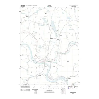
2010 Map of Tunkhannock
USGS Topo · Published 2010About this map
The Susquehanna River bends sharply through Wyoming County, framing the historic borough of Tunkhannock. This landscape is defined by its dramatic waterway junctions, where Tunkhannock Creek, Bowman Creek, and Jackson Creek converge with the river. Significant local elevation is noted at Avery Mountain and Osterhout Mountain, while First Island, Second Island, and Third Island break the river's flow.
Find a feature on this map
121 named features on this map. Tap any name to fly to it.
Don’t see what you’re looking for? This feature index may not catch every label — zoom into the map to look around manually.
Map Details
Editions of this 2010 Tunkhannock Map
This is the sole edition of this map. No revisions or reprints were ever made.
Other maps of this area

1891 · Harveys Lake
USGS Topo · 1:62,500

1893 · Harvey Lake
USGS Topo · 1:62,500

1893 · Pittston
USGS Topo · 1:62,500

1943 · Scranton
USGS Topo · 1:125,000

1945 · Meshoppen
USGS Topo · 1:62,500

1945 · Auburn Center
USGS Topo · 1:24,000

1945 · Meshoppen
USGS Topo · 1:24,000

1946 · Tunkhannock
USGS Topo · 1:62,500

1946 · Noxen
USGS Topo · 1:24,000

1946 · Ransom
USGS Topo · 1:24,000
Featured Places
- Falls Township, PA
- Tunkhannock, PA
- Lemon Township, PA
- Marcy, Tunkhannock Township
- Aldovin, Lemon Township