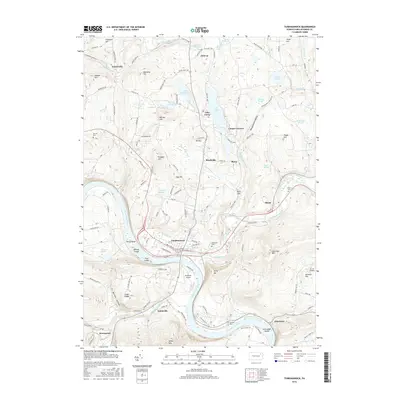
2016 Map of Tunkhannock
USGS Topo · Published 2016About this map
Tunkhannock sits at the confluence where Tunkhannock Creek meets the Susquehanna River, serving as a central hub for this portion of Wyoming County. The landscape is defined by the river’s broad curves, containing islands such as First Island and Second Island, while steep elevations like Osterhout Mtn and Miller Mtn rise sharply from the valley floor. To the north, Lake Carey provides a distinct focal point for smaller settlements including Aldovin and Cooper Corners. The map documents a blend of river-bottom industry and highland agriculture, connected by routes like State Rte 1001. Genealogists may find interest in the several documented burial sites, such as Sunnyside Cem and Dixon Cem, which are situated near established villages. The presence of Skyhaven Airport near the river bend indicates the modern infrastructure supporting this rural corridor.
Find a feature on this map
114 named features on this map. Tap any name to fly to it.
Don’t see what you’re looking for? This feature index may not catch every label — zoom into the map to look around manually.
Map Details
Editions of this 2016 Tunkhannock Map
This is the sole edition of this map. No revisions or reprints were ever made.
Other maps of this area

1891 · Harveys Lake
USGS Topo · 1:62,500

1893 · Harvey Lake
USGS Topo · 1:62,500

1893 · Pittston
USGS Topo · 1:62,500

1943 · Scranton
USGS Topo · 1:125,000

1945 · Meshoppen
USGS Topo · 1:62,500

1945 · Auburn Center
USGS Topo · 1:24,000

1945 · Meshoppen
USGS Topo · 1:24,000

1946 · Tunkhannock
USGS Topo · 1:62,500

1946 · Noxen
USGS Topo · 1:24,000

1946 · Ransom
USGS Topo · 1:24,000
Featured Places
- Falls Township, PA
- Tunkhannock, PA
- Lemon Township, PA
- Marcy, Tunkhannock Township
- Aldovin, Lemon Township