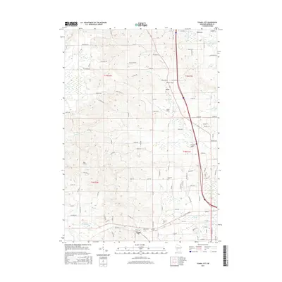
2015 Map of Tunnel City
USGS Topo · Published 2015About this map
Tunnel City sits at a geographic crossroads in Monroe County, marking a landscape where the headwaters of the La Crosse River and several smaller tributaries like Whisky Cr and Mill Cr have carved a series of distinct valleys. The area is characterized by these lowlands, most notably Tarr Valley, which provide natural corridors for transport and settlement. Small communities and clusters of homes are scattered throughout these openings, including Summit Valley, Kirby, Union Valley, and Pleasant Valley. In the north, the village of Warrens serves as a local hub near the Warren Mills Cem. The mapping reveals a high density of small family and community burial grounds, such as Saint Marys Cem, Greenfield Cem, and Boyonton Cem, which offer significant value for genealogical research. The presence of Flora Dell Lake near the western edge adds a focal point for the drainage patterns of Sparta Cr and Tarr Cr within this deeply etched terrain.
Find a feature on this map
101 named features on this map. Tap any name to fly to it.
Don’t see what you’re looking for? This feature index may not catch every label — zoom into the map to look around manually.
Map Details
Editions of this 2015 Tunnel City Map
This is the sole edition of this map. No revisions or reprints were ever made.
Other maps of this area

1916 · Tomah
USGS Topo · 1:62,500

1919 · Kendall
USGS Topo · 1:62,500

1921 · Kendall
USGS Topo · 1:62,500

1947 · Millston
USGS Topo · 1:62,500

1949 · Millston
USGS Topo · 1:62,500

1949 · Tomah
USGS Topo · 1:62,500

1953 · Eau Claire
USGS Topo · 1:250,000

1958 · Eau Claire
USGS Topo · 1:250,000

1958 · Wyeville
USGS Topo · 1:48,000

1958 · La Crosse
USGS Topo · 1:250,000