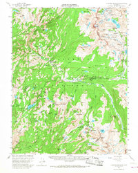
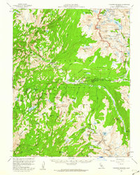
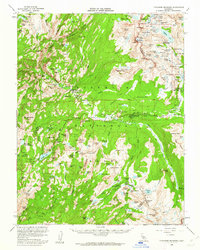
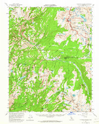
1956 Map of Tuolumne Meadows
USGS Topo · Published 1968About this map
Tuolumne Meadows serves as the central hub of this mid-century survey of the high sierra, where the Tuolumne River begins its descent through a series of dramatic cataracts including Waterwheel Falls and Le Conte Falls. The map documents the established network of high-altitude hospitality, featuring the Tuolumne Meadows High Sierra Camp, Glen Aulin High Sierra Camp, and Vogelsang High Sierra Camp. These backcountry outposts, alongside the Parsons Memorial Lodge at Soda Springs, illustrate the era's focus on accessible wilderness recreation.
Find a feature on this map
166 named features on this map. Tap any name to fly to it.
Don’t see what you’re looking for? This feature index may not catch every label — zoom into the map to look around manually.
Map Details
Editions of this 1956 Tuolumne Meadows Map
5 editions found

Other maps of this area

1896 · Dardanelles
USGS Topo · 1:125,000

1897 · Yosemite
USGS Topo · 1:125,000

1898 · Dardanelles
USGS Topo · 1:125,000

1900 · Yosemite
USGS Topo · 1:125,000

1901 · Mt. Lyell
USGS Topo · 1:125,000

1903 · Yosemite
USGS Topo · 1:125,000

1909 · Yosemite
USGS Topo · 1:125,000

1909 · Bridgeport
USGS Topo · 1:125,000

1911 · Bridgeport
USGS Topo · 1:125,000

1920 · Bridgeport
USGS Topo · 1:125,000