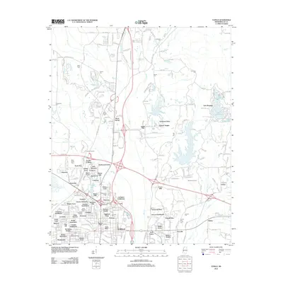
2012 Map of Tupelo
USGS Topo · Published 2012About this map
Tupelo and its surrounding Lee County landscape are defined by a complex network of residential subdivisions and historical transit corridors. The Natchez Trace Pkwy arcs through the western portion of the map, passing landmarks like the Old Town Overlook and the site of the Tupelo National Battlefield. This modern survey reveals a dense pattern of community growth, with named neighborhoods like Beech Springs, Northwood Estates, and Madison Heights filling the spaces between arterial routes such as McCullough Blvd and Jamie Whitten Blvd.
Find a feature on this map
104 named features on this map. Tap any name to fly to it.
Don’t see what you’re looking for? This feature index may not catch every label — zoom into the map to look around manually.
Map Details
Editions of this 2012 Tupelo Map
This is the sole edition of this map. No revisions or reprints were ever made.
Other maps of this area

1921 · Tupelo
USGS Topo · 1:48,000

1923 · Tupelo
USGS Topo · 1:62,500

1955 · Sherman
USGS Topo · 1:62,500

1956 · Tupelo
USGS Topo · 1:250,000

1958 · Tupelo
USGS Topo · 1:250,000

1965 · Mooreville
USGS Topo · 1:24,000

1966 · Evergreen
USGS Topo · 1:24,000

1966 · Bissell
USGS Topo · 1:24,000

1966 · Verona
USGS Topo · 1:24,000

1973 · Guntown
USGS Topo · 1:24,000