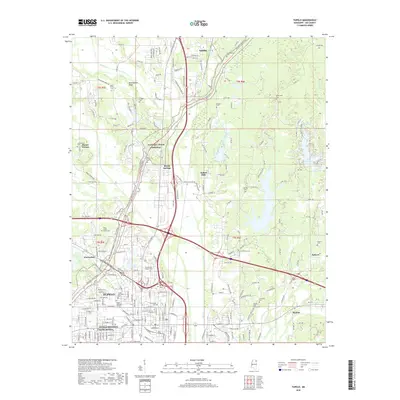
2018 Map of Tupelo
USGS Topo · Published 2018About this map
The Tupelo National Battlefield anchors the southwestern corner of this modern survey, marking the site of significant Civil War conflict amidst the expanding suburban landscape of Tupelo. This Lee County corridor shows the dense intersection of modern infrastructure and deep-rooted community markers, from the Kansas City Southern railroad line to a high concentration of ancestral burial grounds. To the north, the terrain transitions through Devils Backbone toward Saltillo, while residential developments like Indian Hills and Skyline illustrate the region's contemporary growth.
Find a feature on this map
242 named features on this map. Tap any name to fly to it.
Don’t see what you’re looking for? This feature index may not catch every label — zoom into the map to look around manually.
Map Details
Editions of this 2018 Tupelo Map
This is the sole edition of this map. No revisions or reprints were ever made.
Other maps of this area

1921 · Tupelo
USGS Topo · 1:48,000

1923 · Tupelo
USGS Topo · 1:62,500

1955 · Sherman
USGS Topo · 1:62,500

1956 · Tupelo
USGS Topo · 1:250,000

1958 · Tupelo
USGS Topo · 1:250,000

1965 · Mooreville
USGS Topo · 1:24,000

1966 · Evergreen
USGS Topo · 1:24,000

1966 · Bissell
USGS Topo · 1:24,000

1966 · Verona
USGS Topo · 1:24,000

1973 · Guntown
USGS Topo · 1:24,000