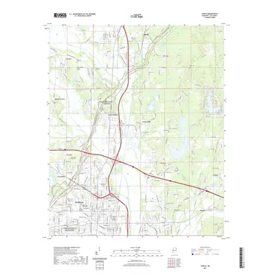
2021 Map of Tupelo
USGS Topo · Published 2021About this map
Tupelo National Battlefield anchors the southwestern portion of this Mississippi landscape, marking a site of significant American history within the modern city limits of Tupelo. The area is defined by its transition from the urban center to the surrounding countryside, where Birmingham Ridge and various watercourses like Mud Cr and Sand Cr shape the terrain. The presence of the Natchez Trace Parkway cutting diagonally through the map highlights the enduring importance of this travel corridor, which connects several smaller communities and residential developments including Saltillo, Beech Springs, and Indian Hills.
Find a feature on this map
246 named features on this map. Tap any name to fly to it.
Don’t see what you’re looking for? This feature index may not catch every label — zoom into the map to look around manually.
Map Details
Editions of this 2021 Tupelo Map
This is the sole edition of this map. No revisions or reprints were ever made.
Other maps of this area

1921 · Tupelo
USGS Topo · 1:48,000

1923 · Tupelo
USGS Topo · 1:62,500

1955 · Sherman
USGS Topo · 1:62,500

1956 · Tupelo
USGS Topo · 1:250,000

1958 · Tupelo
USGS Topo · 1:250,000

1965 · Mooreville
USGS Topo · 1:24,000

1966 · Evergreen
USGS Topo · 1:24,000

1966 · Bissell
USGS Topo · 1:24,000

1966 · Verona
USGS Topo · 1:24,000

1973 · Guntown
USGS Topo · 1:24,000