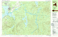
1979 Map of Tupper Lake
USGS Topo · Published 1979About this map
The village of Tupper Lake serves as the focal point for this survey of the northern Adirondacks, illustrating a landscape defined by the winding Raquette River and extensive timberlands. The settlement is densely documented with community landmarks including Mercy General Hospital, the Holy Ghost Academy, and several religious sites like Holy Name Ch. This 1970s record captures the region's transition as old transit lines shifted, noted by the Abandoned railroad corridor running through the town center towards Raquette Pond.
Find a feature on this map
63 named features on this map. Tap any name to fly to it.
Don’t see what you’re looking for? This feature index may not catch every label — zoom into the map to look around manually.
Map Details
Editions of this 1979 Tupper Lake Map
2 editions found
Other maps of this area

1902 · Saranac
USGS Topo · 1:62,500

1904 · Saranac
USGS Topo · 1:62,500

1904 · Santanoni
USGS Topo · 1:62,500

1904 · Long Lake
USGS Topo · 1:62,500

1905 · Saint Regis
USGS Topo · 1:62,500

1907 · Tupper Lake
USGS Topo · 1:62,500

1920 · Childwold
USGS Topo · 1:62,500

1921 · Childwold
USGS Topo · 1:48,000

1922 · Childwold
USGS Topo · 1:62,500

1948 · Ogdensburg
USGS Topo · 1:250,000