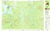
1979 Map of Tupper Lake
USGS Topo · Published 1979About this map
Tupper Lake and its surrounding mountain landscapes are detailed in this late 1970s study of the Adirondack Park. The village center is densely mapped, featuring critical community anchors like Mercy General Hospital, Holy Ghost Academy, and several religious landmarks including Holy Name Ch and Beth Joseph Cem. To the south, the settlement at Moody sits at the base of Mt Morris, while the eastern reaches of the map transition into the sprawling waterways of the Raquette River and Follensby Pond. The infrastructure of the era is evident in the presence of a Landing Strip and a railroad line marked Abandoned, signaling a shift in the regional transportation network. Large expanses of water like Simon Pond and Raquette Pond define the central topography, surrounded by peaks such as Buck Mountain and Panther Mtn.
Find a feature on this map
56 named features on this map. Tap any name to fly to it.
Don’t see what you’re looking for? This feature index may not catch every label — zoom into the map to look around manually.
Map Details
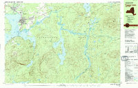
Editions of this 1979 Tupper Lake Map
2 editions found
Other maps of this area

1902 · Saranac
USGS Topo · 1:62,500

1904 · Saranac
USGS Topo · 1:62,500

1904 · Santanoni
USGS Topo · 1:62,500

1904 · Long Lake
USGS Topo · 1:62,500

1905 · Saint Regis
USGS Topo · 1:62,500

1907 · Tupper Lake
USGS Topo · 1:62,500

1920 · Childwold
USGS Topo · 1:62,500

1921 · Childwold
USGS Topo · 1:48,000

1922 · Childwold
USGS Topo · 1:62,500

1948 · Ogdensburg
USGS Topo · 1:250,000