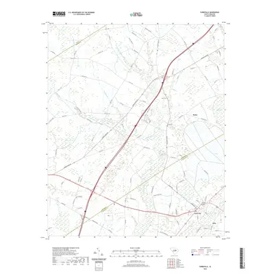
2020 Map of Turbeville
USGS Topo · Published 2020About this map
Turbeville serves as the primary hub of this Lowcountry landscape, situated at the intersection of a modernized road network where the northern tip of Clarendon County meets the Sumter and Lee county lines. The geography is defined by a complex system of blackwater drainages including Puddin Swamp, Budding Swamp, and Hope Swamp, which dictate the placement of local infrastructure and early settlements like Shiloh. These wetlands are punctuated by distinctive geological features such as Dial Bay, reflecting the unique Carolina Bay formations of the region. Local history is anchored by landmarks like Asbury Cem and Shiloh Cem, while the industrial past is hinted at by Woods Millpond. The map captures a moment of modern connectivity as Interstate 95 bisects the traditional agricultural and timber lands, bridging the gap between old communities like Seloc and the evolving regional transit corridors.
Find a feature on this map
95 named features on this map. Tap any name to fly to it.
Don’t see what you’re looking for? This feature index may not catch every label — zoom into the map to look around manually.
Map Details
Editions of this 2020 Turbeville Map
This is the sole edition of this map. No revisions or reprints were ever made.
Other maps of this area

1920 · Mayesville
USGS Topo · 1:48,000

1921 · Mayesville
USGS Topo · 1:62,500

1940 · Florence West
USGS Topo · 1:62,500

1941 · Spartanburg
USGS Topo · 1:250,000

1943 · Mayesville
USGS Topo · 1:62,500

1945 · Florence West
USGS Topo · 1:62,500

1946 · Lake City
USGS Topo · 1:62,500

1949 · Georgetown
USGS Topo · 1:250,000

1953 · Florence
USGS Topo · 1:250,000

1953 · Spartanburg
USGS Topo · 1:250,000