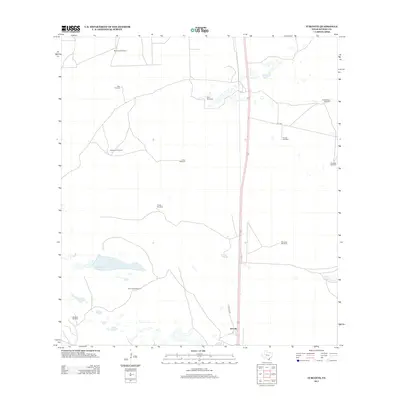
2013 Map of Turcotte
USGS Topo · Published 2013About this map
Turcotte serves as a small anchor point in this expansive Kenedy County landscape, where the reliance on groundwater is immediately evident from the dense network of named windmills. These landmarks, including the Allen Windmill, Rana Windmill, and Corta Sacate Windmill, are critical infrastructure for the ranching operations that define this region of South Texas. The terrain is characterized by scattered water features such as Los Finados Lake and Cayo Grande, which dot the open country between local routes like Turcotte W and CR 1328. The naming convention of these windmills, from Esperanza Windmill to Loba Windmill, suggests a landscape partitioned by historical ranch boundaries and family holdings. This survey provides a precise look at the rural infrastructure and hydraulic landmarks essential for life and industry in this portion of the coastal plains.
Find a feature on this map
17 named features on this map. Tap any name to fly to it.
Don’t see what you’re looking for? This feature index may not catch every label — zoom into the map to look around manually.
Map Details
Editions of this 2013 Turcotte Map
This is the sole edition of this map. No revisions or reprints were ever made.
Other maps of this area

1923 · Armstrong
USGS Topo · 1:62,500

1923 · Saltillo Ranch
USGS Topo · 1:62,500

1928 · Sarita
USGS Topo · 1:125,000

1950 · Corpus Christi
USGS Topo · 1:250,000

1952 · La Parra Ranch
USGS Topo · 1:24,000

1953 · Brownsville
USGS Topo · 1:250,000

1954 · La Parra Ranch SW
USGS Topo · 1:24,000

1954 · Sarita
USGS Topo · 1:62,500
1955 · La Parra Ranch
USGS Topo · 1:62,500

1956 · Corpus Christi
USGS Topo · 1:250,000