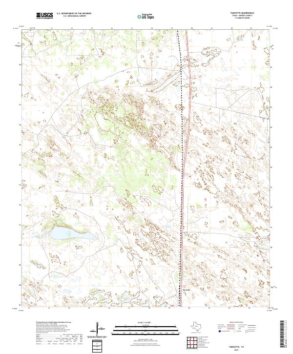
2022 Map of Turcotte
USGS Topo · Published 2022About this map
Turcotte stands as a small settlement in the heart of the South Texas brush country, situated along the primary north-south corridor of Route 77. This area of Kenedy County is characterized by a sparse, ranching-oriented landscape where traditional water sources like Los Finados Lake are critical markers in an otherwise uniform terrain of scrub and intermittent wetlands. The 2022 survey illustrates the modern isolation of this region, where vast private landholdings are punctuated only by the occasional waypoint along the highway. Researchers of South Texas history will find the map reflects the enduring, unchanged nature of the coastal plains, showing how transportation routes have long dictated the placement of small community hubs in this expansive territory.
Find a feature on this map
3 named features on this map. Tap any name to fly to it.
Don’t see what you’re looking for? This feature index may not catch every label — zoom into the map to look around manually.
Map Details
Editions of this 2022 Turcotte Map
This is the sole edition of this map. No revisions or reprints were ever made.
Other maps of this area

1923 · Armstrong
USGS Topo · 1:62,500

1923 · Saltillo Ranch
USGS Topo · 1:62,500

1928 · Sarita
USGS Topo · 1:125,000

1950 · Corpus Christi
USGS Topo · 1:250,000

1952 · La Parra Ranch
USGS Topo · 1:24,000

1953 · Brownsville
USGS Topo · 1:250,000

1954 · La Parra Ranch SW
USGS Topo · 1:24,000

1954 · Sarita
USGS Topo · 1:62,500
1955 · La Parra Ranch
USGS Topo · 1:62,500

1956 · Corpus Christi
USGS Topo · 1:250,000