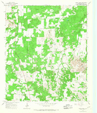
1965 Map of Turkey Creek
USGS Topo · Published 1967About this map
Deaton Mountain and the Twin Mountains dominate this 1960s landscape in Erath County, where the terrain is deeply etched by a complex drainage network. The map reveals a rural Texas environment defined by its watercourses, including the meandering paths of Barton Creek, Sunday Creek, and Turkey Creek. This era of the mid-twentieth century shows the integration of industrial infrastructure within the cattle-country landscape, evidenced by a prominent Pipeline and multiple gas wells scattered across the hills. For those researching local families and old community centers, the map identifies small but significant sites like Russel Chapel Cem, Liberty Cem, and the uniquely named X Ray Cem. Small industrial footprints such as a Gravel Pit near Hannibal Creek suggest local resource extraction during this period of development.
Find a feature on this map
19 named features on this map. Tap any name to fly to it.
Don’t see what you’re looking for? This feature index may not catch every label — zoom into the map to look around manually.
Map Details
Editions of this 1965 Turkey Creek Map
This is the sole edition of this map. No revisions or reprints were ever made.
Other maps of this area

1890 · Stephenville
USGS Topo · 1:125,000

1891 · Palo Pinto
USGS Topo · 1:125,000

1918 · Palo Pinto
USGS Topo · 1:125,000

1920 · Stephenville
USGS Topo · 1:125,000

1931 · Santo
USGS Topo · 1:62,500

1954 · Abilene
USGS Topo · 1:250,000

1958 · Abilene
USGS Topo · 1:250,000
1959 · Lipan
USGS Topo · 1:62,500

1959 · Gordon
USGS Topo · 1:62,500

1961 · Knob Hill
USGS Topo · 1:24,000