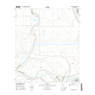
2015 Map of Turnbull Island
USGS Topo · Published 2015About this map
Turnbull Island dominates this alluvial landscape where the meandering Red River and Mississippi River have historically shifted their paths, creating a complex network of chutes and oxbows. The terrain is defined by water features like the Upper Old River and Lower Old River, illustrating the river's former channels. Small settlements like Merrick are positioned along the southern edge, while the interior of the island contains a scattering of family and community landmarks. Genealogists will find several burial grounds mapped here, including Turnbull Cem, Oak Grove Cem, Royal Oak Cem, and Union Cem. The area is a labyrinth of bayous and lakes, from the curiously named Les Petits Lacs à Blakewood to Shark Bay and Kellers Lake, connected by access routes such as Bean Field Rd and La-418. This mapping provides a contemporary record of these shifting river boundaries across several parish lines.
Find a feature on this map
47 named features on this map. Tap any name to fly to it.
Don’t see what you’re looking for? This feature index may not catch every label — zoom into the map to look around manually.
Map Details
Editions of this 2015 Turnbull Island Map
This is the sole edition of this map. No revisions or reprints were ever made.
Other maps of this area

1939 · Artonish
USGS Topo · 1:62,500

1941 · Voorhies
USGS Topo · 1:62,500

1941 · Batchelor
USGS Topo · 1:62,500

1953 · Natchez
USGS Topo · 1:250,000

1954 · Artonish
USGS Topo · 1:62,500

1954 · Baton Rouge
USGS Topo · 1:250,000

1955 · Artonish
USGS Topo · 1:62,500

1955 · Batchelor
USGS Topo · 1:62,500

1955 · Odenburg
USGS Topo · 1:62,500

1956 · Natchez
USGS Topo · 1:250,000
Featured Places
- Merrick, LA
- Avoyelles Parish, LA
- Pointe Coupee Parish, LA
- Concordia Parish, LA
- West Feliciana Parish, LA