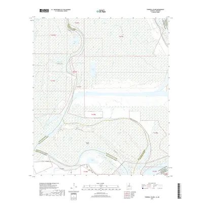
2018 Map of Turnbull Island
USGS Topo · Published 2018About this map
The Red River creates a complex hydrologic landscape at the confluence of several parishes, winding past the namesake Turnbull Island and defining the boundaries of Avoyelles, Concordia, West Feliciana, and Pointe Coupee. This 2018 survey documents a region of intricate bayous and oxbow lakes, including the distinctive arc of Upper Old River and Lower Old River. The settlement pattern is sparse, concentrated near the southern margin where LA Highway 418 traverses the landscape near Bayou Moreau.
Find a feature on this map
50 named features on this map. Tap any name to fly to it.
Don’t see what you’re looking for? This feature index may not catch every label — zoom into the map to look around manually.
Map Details
Editions of this 2018 Turnbull Island Map
This is the sole edition of this map. No revisions or reprints were ever made.
Other maps of this area

1939 · Artonish
USGS Topo · 1:62,500

1941 · Voorhies
USGS Topo · 1:62,500

1941 · Batchelor
USGS Topo · 1:62,500

1953 · Natchez
USGS Topo · 1:250,000

1954 · Artonish
USGS Topo · 1:62,500

1954 · Baton Rouge
USGS Topo · 1:250,000

1955 · Artonish
USGS Topo · 1:62,500

1955 · Batchelor
USGS Topo · 1:62,500

1955 · Odenburg
USGS Topo · 1:62,500

1956 · Natchez
USGS Topo · 1:250,000
Featured Places
- Merrick, LA
- Avoyelles Parish, LA
- Pointe Coupee Parish, LA
- Concordia Parish, LA
- West Feliciana Parish, LA