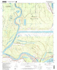
1996 Map of Turnbull Island
USGS Topo · Published 1999About this map
The confluence of the Red River and Mississippi River dominates this landscape in the late 1990s, where the shifting hydrology of Concordia Parish is preserved in a maze of oxbows and bayous. The map centers on Turnbull Island, a landform defined by the Upper Old River and the engineered Outflow Channel. Cultural markers are concentrated in the southern sections, where local faith and history are anchored by Oak Grove Ch and Royal Oak Ch.
Find a feature on this map
53 named features on this map. Tap any name to fly to it.
Don’t see what you’re looking for? This feature index may not catch every label — zoom into the map to look around manually.
Map Details
Editions of this 1996 Turnbull Island Map
This is the sole edition of this map. No revisions or reprints were ever made.
Other maps of this area

1939 · Artonish
USGS Topo · 1:62,500

1941 · Voorhies
USGS Topo · 1:62,500

1941 · Batchelor
USGS Topo · 1:62,500

1953 · Natchez
USGS Topo · 1:250,000

1954 · Artonish
USGS Topo · 1:62,500

1954 · Baton Rouge
USGS Topo · 1:250,000

1955 · Artonish
USGS Topo · 1:62,500

1955 · Batchelor
USGS Topo · 1:62,500

1955 · Odenburg
USGS Topo · 1:62,500

1956 · Natchez
USGS Topo · 1:250,000
Featured Places
- Merrick, LA
- Avoyelles Parish, LA
- Pointe Coupee Parish, LA
- Concordia Parish, LA
- West Feliciana Parish, LA