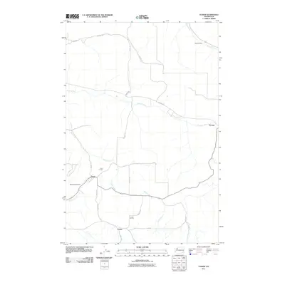
2011 Map of Turner
USGS Topo · Published 2011About this map
Willow Creek and the Tucannon River carve through the agricultural landscape of northern Columbia County, defining the settlement patterns of this rural region. Small communities and historical landing points like Turner, Marengo, and Covello are connected by a web of local roads such as Emerson Rd and Tucannon Rd. The topography is marked by distinct depressions and corridors, including Whetstone Hollow and the Pataha Valley to the northeast. For genealogists and local historians, the map preserves the exact locations of the Turner Cemetery and Covello Cemetery, which serve as vital anchors for the area's pioneer history. The drainage network, featuring Whetstone Creek and Pataha Creek, illustrates the reliance on natural watercourses for the placement of early homesteads and transportation routes across the high plateaus.
Find a feature on this map
24 named features on this map. Tap any name to fly to it.
Don’t see what you’re looking for? This feature index may not catch every label — zoom into the map to look around manually.
Map Details
Editions of this 2011 Turner Map
This is the sole edition of this map. No revisions or reprints were ever made.
Other maps of this area

1937 · Pomeroy
USGS Topo · 1:96,000

1942 · Pomeroy
USGS Topo · 1:125,000

1950 · Penawawa
USGS Topo · 1:62,500

1950 · Hay
USGS Topo · 1:62,500

1952 · Hay
USGS Topo · 1:62,500

1955 · Pullman
USGS Topo · 1:250,000

1958 · Pullman
USGS Topo · 1:250,000

1967 · Hopkins Ridge
USGS Topo · 1:24,000

1967 · Cahill Mtn
USGS Topo · 1:24,000

1967 · Turner
USGS Topo · 1:24,000