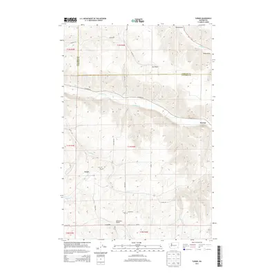
2013 Map of Turner
USGS Topo · Published 2013About this map
The Tucannon River winds through this section of Washington where the Columbia and Garfield county lines meet. The landscape is defined by the significant elevation changes between the Pataha Valley to the north and the deep incisions of Dry Hollow and Whetstone Hollow. Small agricultural communities like Turner and Covello serve as focal points for the surrounding rural area, connected by a network of local routes including Covello Rd and Tucannon Rd. Genealogists may find interest in the documented locations of the Turner Cem and Covello Cem, which sit near their respective namesake settlements. To the east, the settlement of Marengo overlooks the river valley, marking a transition in the local topography near where Pataha Cr cuts through the northeast corner of the quadrangle.
Find a feature on this map
32 named features on this map. Tap any name to fly to it.
Don’t see what you’re looking for? This feature index may not catch every label — zoom into the map to look around manually.
Map Details
Editions of this 2013 Turner Map
This is the sole edition of this map. No revisions or reprints were ever made.
Other maps of this area

1937 · Pomeroy
USGS Topo · 1:96,000

1942 · Pomeroy
USGS Topo · 1:125,000

1950 · Penawawa
USGS Topo · 1:62,500

1950 · Hay
USGS Topo · 1:62,500

1952 · Hay
USGS Topo · 1:62,500

1955 · Pullman
USGS Topo · 1:250,000

1958 · Pullman
USGS Topo · 1:250,000

1967 · Hopkins Ridge
USGS Topo · 1:24,000

1967 · Cahill Mtn
USGS Topo · 1:24,000

1967 · Turner
USGS Topo · 1:24,000