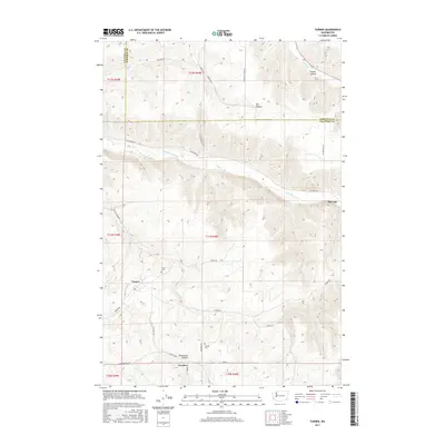
2017 Map of Turner
USGS Topo · Published 2017About this map
The Pataha Valley and the steep canyons of the Tucannon River define this corner of the Palouse, where the border between Garfield and Columbia counties winds through a high-plateau landscape. Settlement is centered on the small communities of Turner and Covello, which sit amidst a network of hollows including Dry Hollow and Whetstone Hollow. This modern survey documents a rural environment deeply connected to its early 20th-century origins through the preservation of the Turner Cem and Covello Cem. The drainage patterns of Willow Cr and Whetstone Cr dictate the layout of the road system, which remains largely composed of rural routes like Jackson Grade Rd and Tucannon Rd. This topography reveals the persistent isolation and agrarian focus of the region, where tiny hamlets like Marengo still mark the landscape near the river's edge.
Find a feature on this map
37 named features on this map. Tap any name to fly to it.
Don’t see what you’re looking for? This feature index may not catch every label — zoom into the map to look around manually.
Map Details
Editions of this 2017 Turner Map
This is the sole edition of this map. No revisions or reprints were ever made.
Other maps of this area

1937 · Pomeroy
USGS Topo · 1:96,000

1942 · Pomeroy
USGS Topo · 1:125,000

1950 · Penawawa
USGS Topo · 1:62,500

1950 · Hay
USGS Topo · 1:62,500

1952 · Hay
USGS Topo · 1:62,500

1955 · Pullman
USGS Topo · 1:250,000

1958 · Pullman
USGS Topo · 1:250,000

1967 · Hopkins Ridge
USGS Topo · 1:24,000

1967 · Cahill Mtn
USGS Topo · 1:24,000

1967 · Turner
USGS Topo · 1:24,000