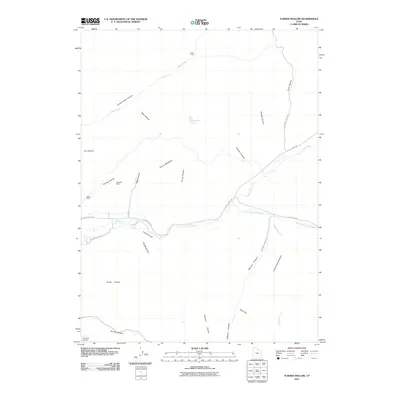
2011 Map of Turner Hollow
USGS Topo · Published 2011About this map
Chalk Creek carves a central path through this Summit County landscape, where the valley floor transitions into a series of named hollows and canyons. To the south, the Hoytsville Cemetery provides a primary genealogical touchstone, while the historical industrial footprint is marked by the Chappell Mine and Weber Mine in the western hills. The network of drainage and transportation is defined by E Chalk Creek Rd, which follows the water past the Narrows toward the eastern reaches of the quadrangle.
Find a feature on this map
32 named features on this map. Tap any name to fly to it.
Don’t see what you’re looking for? This feature index may not catch every label — zoom into the map to look around manually.
Map Details
Editions of this 2011 Turner Hollow Map
This is the sole edition of this map. No revisions or reprints were ever made.
Other maps of this area

1885 · Salt Lake
USGS Topo · 1:250,000

1900 · Coalville
USGS Topo · 1:125,000

1903 · Coalville
USGS Topo · 1:125,000

1954 · Salt Lake City
USGS Topo · 1:250,000

1954 · Ogden
USGS Topo · 1:250,000

1958 · Ogden
USGS Topo · 1:250,000

1958 · Salt Lake City
USGS Topo · 1:250,000

1960 · Ogden
USGS Topo · 1:250,000

1960 · Salt Lake City
USGS Topo · 1:250,000
1964 · Henefer
USGS Topo · 1:24,000