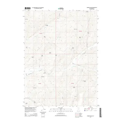
2014 Map of Turner Hollow
USGS Topo · Published 2014About this map
Turner Hollow and Turner Meadows sit at the center of this high-elevation landscape in Summit County, where the terrain is defined by a dense network of canyons and creeks. The drainage patterns of Chalk Cr and its tributaries, including the S Fork Chalk Cr, carve through the land, creating distinctive topographical features like The Narrows and The Meadows. To the south, Hoytsville Airport provides a modern navigational point near Spring Canyon, while the high ridge of the Elkhorn Divide separates the southern watersheds.
Find a feature on this map
41 named features on this map. Tap any name to fly to it.
Don’t see what you’re looking for? This feature index may not catch every label — zoom into the map to look around manually.
Map Details
Editions of this 2014 Turner Hollow Map
This is the sole edition of this map. No revisions or reprints were ever made.
Other maps of this area

1885 · Salt Lake
USGS Topo · 1:250,000

1900 · Coalville
USGS Topo · 1:125,000

1903 · Coalville
USGS Topo · 1:125,000

1954 · Salt Lake City
USGS Topo · 1:250,000

1954 · Ogden
USGS Topo · 1:250,000

1958 · Ogden
USGS Topo · 1:250,000

1958 · Salt Lake City
USGS Topo · 1:250,000

1960 · Ogden
USGS Topo · 1:250,000

1960 · Salt Lake City
USGS Topo · 1:250,000
1964 · Henefer
USGS Topo · 1:24,000